If you are having any difficulty using this website, please contact the Help Desk at Help@nullHofstra.edu or 516-463-7777 or Student Access Services at SAS@nullhofstra.edu or 516-463-7075. Please identify the webpage address or URL and the specific problems you have encountered and we will address the issue.
Students will develop the basic observational skills they need to function as geoscientists.
Students will make measurements and use various quantitative units to describe phenomena and will practice converting quantities from one unit to another.
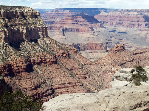
Students will use maps (topographic and geologic) to estimate distances, visualize landforms, and locate / identify geographic and geologic features.
Students will identify common minerals in hand samples and in field exposures of rock using visual clues and simple tests.
Students will identify the common forms of igneous, metamorphic, and sedimentary rock in hand samples and in field exposures using observations of mineral composition and texture.
Students will identify types of fossils commonly found in Paleozoic, Mesozoic, and Cenozoic rocks.
Students will identify common structures and bed features in igneous, metamorphic, and sedimentary strata.
Students will perform tests and collect data to analyze geological materials, features, and processes both qualitatively and quantitatively.
Using a variety of tools and instrumentation, students will describe and quantify the mineral / paleontological composition, grain distribution, and textural properties, bed forms, and structures of earth materials and strata.
Using a topographic map, students will measure elevation, construct accurate vertical profiles and calculate vertical exaggeration.
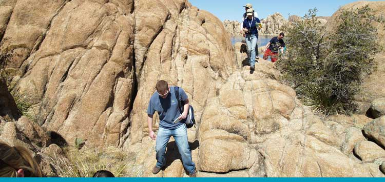
Students will use tools such as a compass, Jacob staff, stereonet, or sight level to orienteer, to map topographic and geologic features, and to measure the thickness and three-dimensional orientation of planar and linear features in rock outcrops.
Students will use computer spreadsheets and / or geotechnical software to manage and analyze data.
Students will apply critical thinking skills such as inductive, deductive, and mathematical reasoning to solve geological problems using the scientific method.
Using the information shown on a geologic map, students will interpret topographic, lithologic, and structural data to inductively generate an accurate geologic cross section.
Using observations and measurements of lithological, paleontological, and / or geochemical properties, students will interpret the history and environment of formation of rock samples and strata.
Utilizing data from paleontology and / or isotopic analysis, students will discriminate between absolute and relative time and will demonstrate the ability to apply a variety of methods to solve problems of dating and stratigraphic correlation in geology.
Students will extract data and interpret features observed on maps, photos, DEMs, and / or stratigraphic sections to infer geologic processes and interpret geologic history.
Students will demonstrate the ability to integrate new data with their current understanding of geologic systems to formulate or evaluate a hypothesis.
Students will apply mathematical models and analysis to quantitatively describe or predict the behavior of geological phenomena.
Students will synthesize the principles learned in the classroom, in the laboratory, and during field studies to identify geological features, interpret geological history, and solve geological problems.
Students will create a geologic map, cross section, and / or stratigraphic column based on field measurements and interpret the geologic history, analyze the geologic properties or processes at work, or predict the future behavior of the area studied.
Students will integrate data from field work, laboratory measurements, library research, and / or their coursework to formulate or evaluate a hypothesis.
Students will demonstrate the ability to acquire and communicate scientific data, ideas, and interpretations through written, oral, visual, and digital means.
Students will demonstrate the ability to accurately report on and draw conclusions from close readings of works of scientific journalism and research literature.
Students will use the Hofstra library and online databases to search for, locate, and retrieve publications relevant to a research question or project.
Students will produce written reports that clearly and accurately describe and illustrate the background, methods, data, and interpretations relevant to a particular project.
Students will produce and present oral reports based on posters or digital media (e.g. Power Point) that clearly and accurately describe and illustrate the background, methods, data, and interpretations relevant to a particular project.
Students will demonstrate the ability to accurately and ethically incorporate and cite a variety of scholarly sources in their written reports and oral presentations, and will evaluate the relative reliability of sources of information and discriminate between peer-reviewed, edited, and “wiki” publishing.
Students will demonstrate proficiency using digital photography and image processing / drafting software to generate scientific illustrations, maps, diagrams, and/or graphs.
Program Goals
Students will participate in undergraduate research under the direction of Hofstra faculty mentors and present the results of their work at professional meetings and in professional journals.
Students will gain acceptance to and participate in sponsored undergraduate research opportunities and internships at commercial firms and other research institutions.
Students will gain access to employment in professions of their choosing related to Earth Science.
Students will gain acceptance to reputable graduate programs in the Earth Sciences and Science Education.